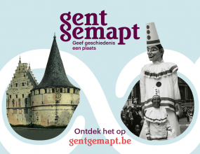
Gent Gemapt is a a participative geotemporal platform for sharing, presenting and using digital heritage collections
In this digital heritage project (September 2020-2023) we link archival and heritage collections with historical maps to reconnect them with each other, with the city and the people from Ghent. The basic assumption is that all kinds of data and source types can be 'mapped' and that georeferencing and annotation are inviting methods for the public to unlock our heritage. With Gent Gemapt we put the concept of a 'deep map' into practice and aim to create a multidimensional map of the city that provides better insight into the urban landscape, for the public as well as for researchers. We will use IIIF-technology to integrate heritage collections by multiple partners and develop further Madoc technology to annotate images, archival documents and maps participativly. The enhancer of our platform is Omeka S.
In the core of Gent Gemapt, GhentCDH is working on an Urban Gazetteer of the city of Ghent. An Urban Gazetteer is a list, a collection of 'places' (streets, buildings, monuments, water) with all their temporal and spatial properties. An Urban Gazetteer is an invaluable tool for organizing information for anyone who wants to do research or who wants to 'archive' the city history. Gazetteers provide unique identifiers - in the form of URIs - enabling us to connect data coming from different digital sources, archives, and libraries more easily.
As a development heritage project, Gent Gemapt is financed by the Flemish Government - Departement Cultuur Jeugd Sport en Media. Partners in the heritage project are Ghent University Library, AMSAB-ISG, Liberas, STAM Gent, Archief Gent, Huis van Alijn en Industriemuseum. GhentCDH finances the development of underlying technologies and the Urban Gazetteer with support of Clariah-Vlaanderen.
Gent Gemapped was launched in june 2023
Check it out @ GentGemapt.be
-
De Kaart" is the core of Ghent Gemapt. It is an innovative presentation platform that spatially unlocks the splendor of Ghent's heritage collections. It allows you to search, zoom and scroll through time and space of the city.
-
"Gent Verrijkt" stands next to De Kaart and is the digital toolbox of Gent Gemapt. Here, museums and archives enlist the help of volunteers to help transcribe, date, describe and identify their collections.
-
After its launch, Gent Gemapt continues to grow and the partners continue to build on the heritage presentation and enrichment via GentGemapt.be.
-
@GhentCDH we will keep on working on and with GentGemapt.be for anonther while!
-
Read About Gent Gemapt and About the project.
Questions? Ideas? Want to work together?
Get in touch!
- Fien, project coordinator: fien.danniau@ugent.be
- Vincent, data modeler: vincent.ducatteeuw@ugent.be
- Rein, cartographer: rein.debrulle@ugent.be
- Frederic, developer: frederic.lamsens@ugent.be


